Aerial Photogrammetry / Aerial Mapping allows capture of high-resolution imagery over large areas of ground. Our software does this by combining hundreds or even thousands of drone images into a single high-definition map-style image. Once the data is captured it is processed and delivered into several formats, ready to be used by your software. It can be used for any project from a single family property to a large campus and everything in between.
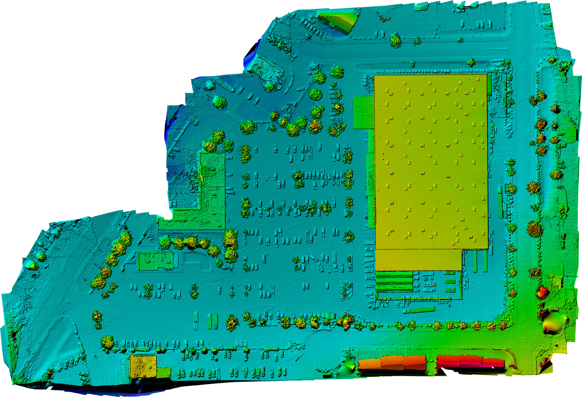
Below is a map that we built for a client for parking lot measurement and inspection at a Home Depot

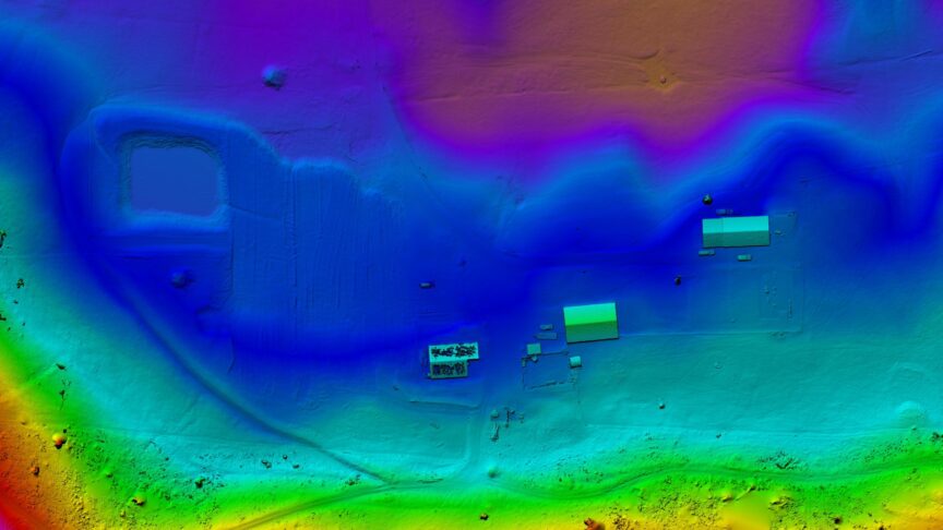
Here is the same image in elevation view
Here is the overlay of the image on Google Maps
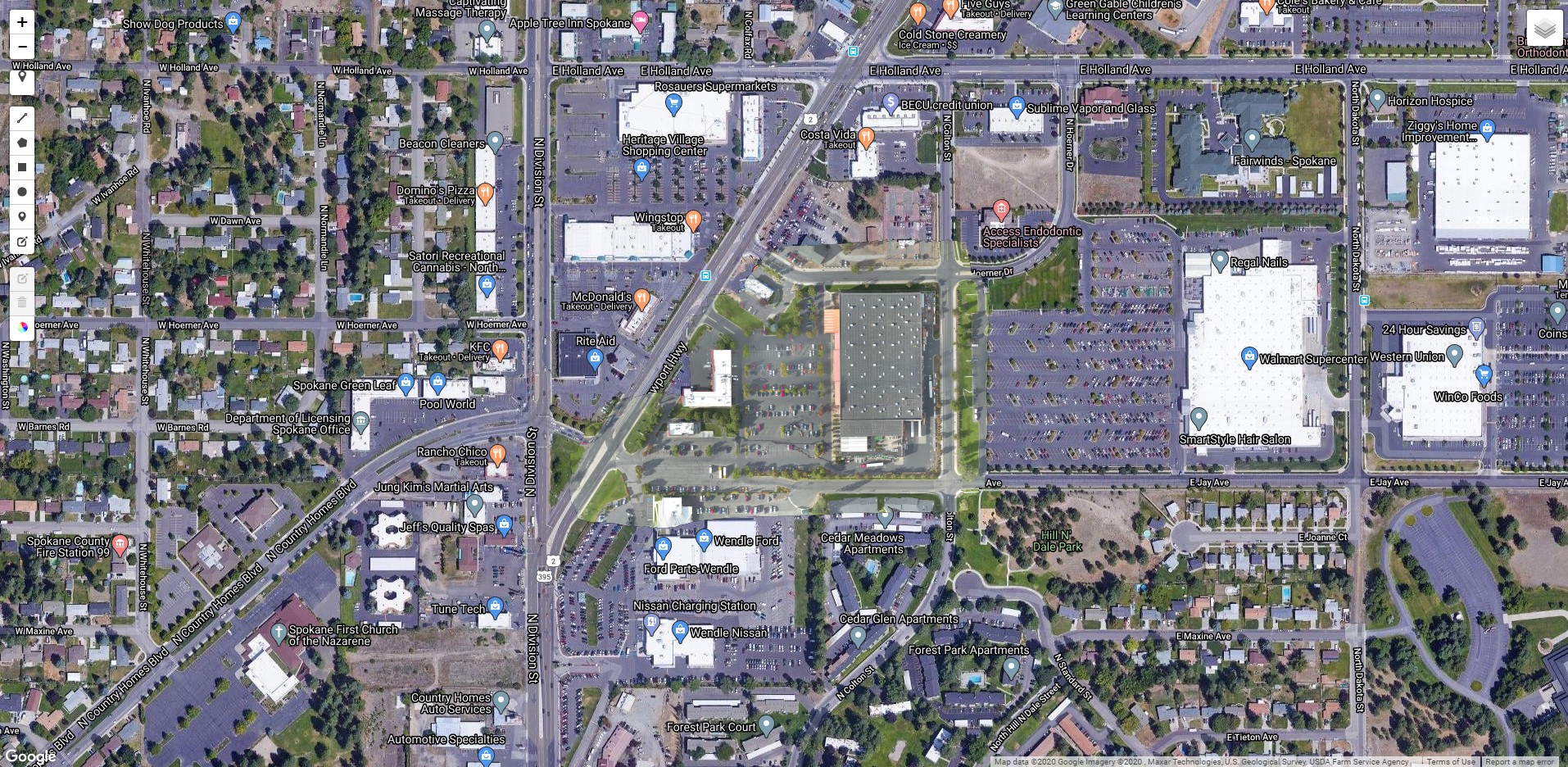
View a link to the overlay map here – zoom in to see the high detail overlay
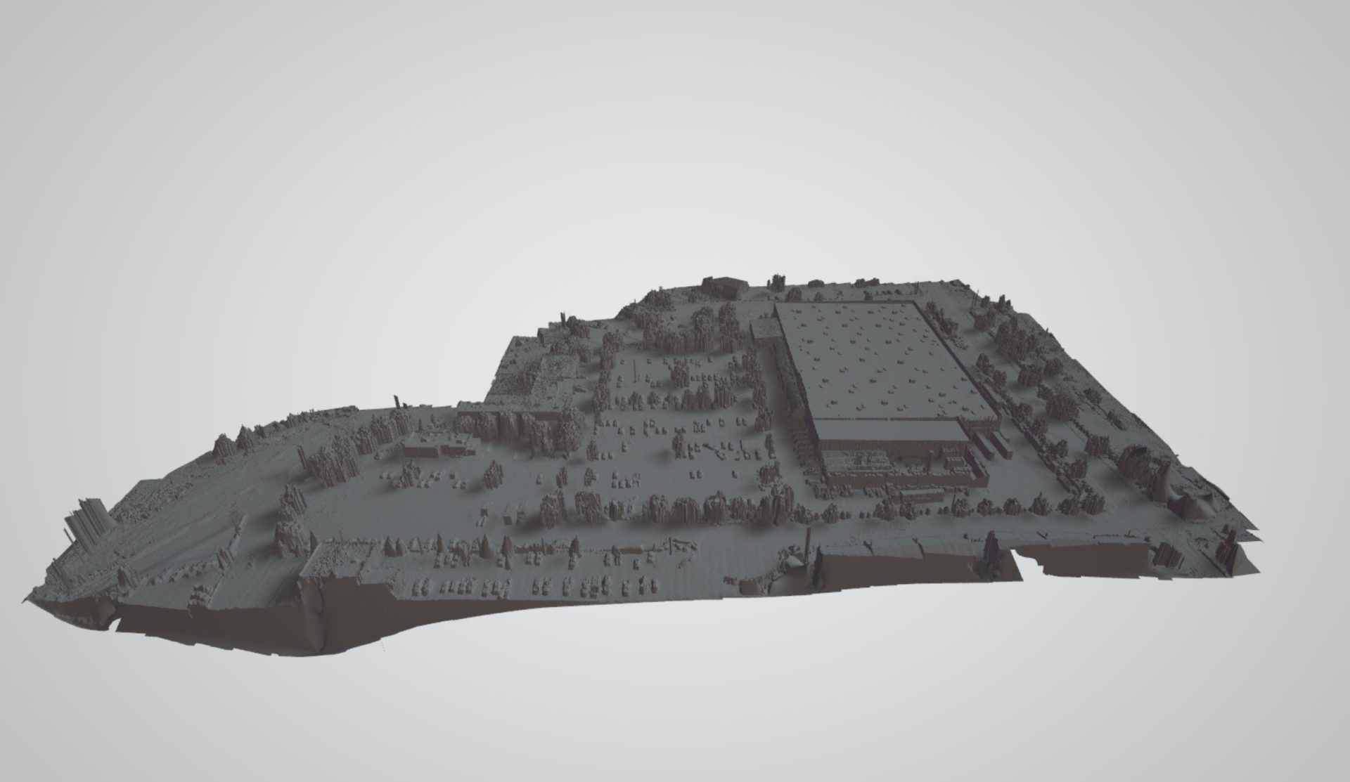
The data from the elevation map can also be used to build a basic 3D model of the area
The deliverables from our mapping software includes the following file types
- GeoTIFF (TIF)
- Full Resolution Image (JPG)
- DEM GeoTiff (TIF)
- Colorized DEM GeoTIFF (TIF)
- Colorized DEM (JPG)
- 3D Google Earth (KMZ)
- Point Cloud (LAS)
- Point Cloud XYZ RGB (TXT)
- 3D Model (OBJ)
- 3D Material (MTL)
- 3D Texture (JPG)
Many of these files can be used directly with CAD/Drawing software to enhance the design of your project.
Contact us today to discuss how this new technology will benefit your project